Hi Jordan -
An interesting question and I think I can at least point you to some useful resources.
The 1901 census areas were based on the 1895 electoral divisions and there is a marvelous atlas archived on the LAC site. The map for Marquette is here, although I don't see any areas marked as Unorganized Territory or know enough about Manitoba geography to help you further.
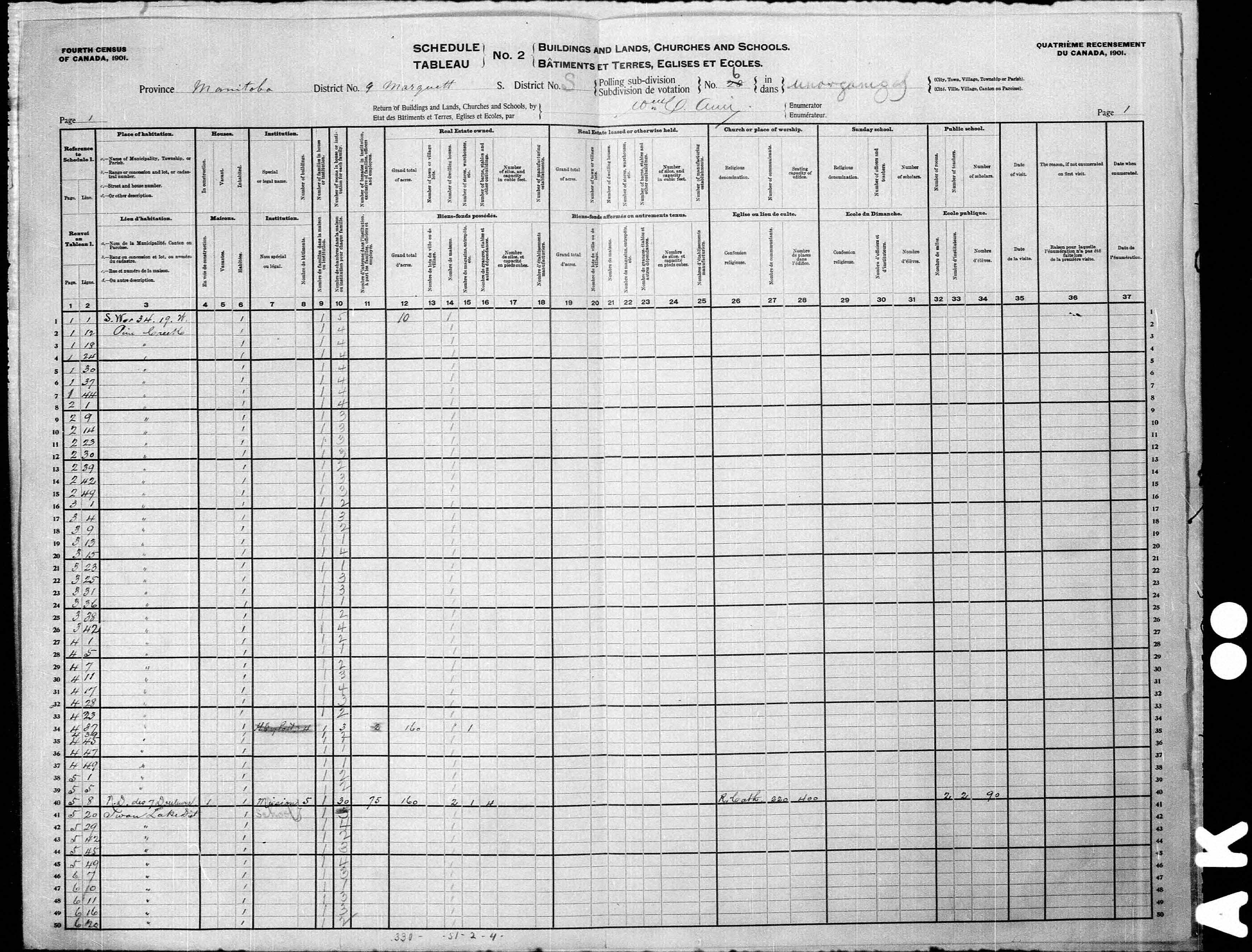
http://www.collectionscanada.gc.ca/elec ... ge_nbr=198Your next step is to look at the Schedule 2s for 1901, which provide addresses. This is particularly useful for urban areas where you will usually get a specific civic address but even in rural areas there can be useful information. The digitized images aren't always properly labelled by LAC, so sometimes it requires poking around nearby links. For example, with the Marquette Unorganized Territories (on page 29 of the Manitoba Pdf) there are multiple ones labeled S1 and one of these seems to correspond to S6 in the AG census pages (the name of the enumerator matches). My reading of the location reads "S W 34.19.W Pine Creek" (I think - other sub-districts have three numbers for sector, township and range so I don't know how to read this).
http://data2.collectionscanada.ca/1901/ ... 022678.jpgOther nearby pages have less or more information. For example one has this interesting note: "These lands have just been surveyed last fall but are not yet open for entry. These Galitians have no entry but have squatted on the land." (I'm guessing Galitians should be Galicians.)
I generally access the Electoral Map, the Schedules and other information from this page:
http://www.bac-lac.gc.ca/eng/census/190 ... .aspx#tab7I am going to paste your question and my answer to the AG Facebook group to see if anyone there has more to add.
Thanks for your interest. Mark

